
West Falls
West Falls, New York
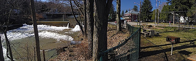
Location: Central Erie County, Route 240, West Falls. A parking area for a veterans park is located on the east side of Route 240 just north of Bridge Street. The falls is plainly visible from the parking lot.
 
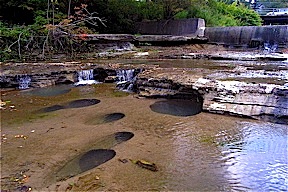
West Falls is a natural cascade with a seven foot drop with a four foot high dam built on top of it. The crest of the dam is 100 feet wide, faces to the north northeast and has an elevation of 930 feet. When the creek is low numerous pot holes can be seen in the creek bead.
One of the early settlers of West Falls was Abram Smith. In 1807 he built a grist mill on the west side of the West Branch of Cazenovia Creek a short distance down stream of the falls. The creek also provided power for a few other saw mills in the area. The Village of West Falls was originally known as Crockershire and then Florence. When the residents wanted a village post office they found that there already was a Florence, New York so the village name was changed to West Falls in 1849. In 1866 the village had two general stores and three hotels.
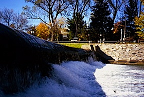 
West Falls from the east creek bank.
A few of the pot holes at West Falls.
For a MapQuest map of the area click here.
For a ACME Mapper 2.0 map of the area click here.
Web site: ???
Copyright © 2007 by Scott A. Ensminger.
This information may not be reproduced without written permission.
 You can send me e-mail at:falzguy@verizon.net
Return to Waterfalls You Can Visit In Erie County
Return to Waterfall Listing By County
Return to Home Page of WNYWS
|