Location: North Central Orleans County, Park Avenue, Waterport.
Starting from the intersection of Routes 98 and 104, drive west on Route 104 for 1.2 miles to Route 279 (Gaines Road) and turn right (north). In about 2.2 miles Route 279 will make a turn to the left. Do not turn, keep going straight and continue northwards onto Park Avenue. In roughly 1 mile, after crossing the Waterport-Carlton road, you will come to a DEC parking area for fishing access to the Oak Orchard River. The parking area is on the left (west) side of the road, just past a power substation.

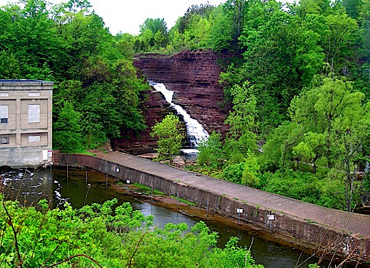
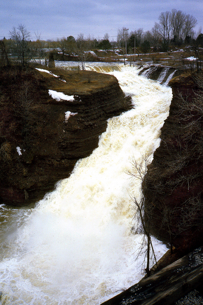
 Waterport Falls is actually a manmade spillway for the Waterport Generating Station owned by Brookfield Power. Built around 1920, the dam for the hydropower plant created a long narrow lake originally called Lake Carlton, then Waterport Pond, and now Lake Alice. As the waters of Lake Alice first pass over the spillway dam they flow northward. The spillway channel, which is cut in the reddish colored Queenston Shale, then narrows to about 40 feet in width and gradually turns to the northeast. The spillway has a vertical drop of around 65 feet. It is best seen in early to mid spring, as it may be nearly dry in the summer months.
From the DEC parking area follow the trail westwards as it descends steeply to the Oak Orchard River. At the bottom of the hill turn left (southwest) and follow the trail as it passes behind the Brookfield Power Plant. Continue to the northeast on the concrete pier for a closer view of the falls. Brookfield Power allows access to this area for fishing and viewing of the falls. Please obey all signs as they are for your safety. This access is provided as a public benefit.
A December 2007 email from Brookfield Power states that because of limited land holdings and the dangerous cliffs and embankments around the falls, Brookfield Power does not allow access to view the falls from the western side along Clarks Mills Road. No trespassing is enforced in this area.
 You can send me e-mail at:falzguy@verizon.net