Waterfalls You Can Visit In
Letchworth State Park
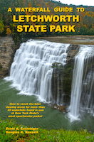
 A Waterfall Guide to Letchworth State Park by Scott A. Ensminger and Douglas K. Bassett. Now in its third edition this 104 page expanded and updated guide contains directions on how to reach the best viewing area for more than 25 waterfalls found in the park. There are nine maps that show the locations of the waterfalls and the trails used to reach the viewing areas. Over 50 black and white photographs of the waterfalls are included in the guide.
Click on the cover photo to the left for more information.
To purchase a copy of the guidebook click on the gold button

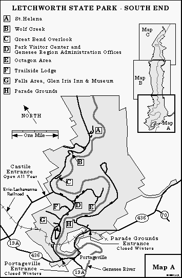
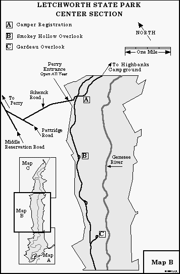
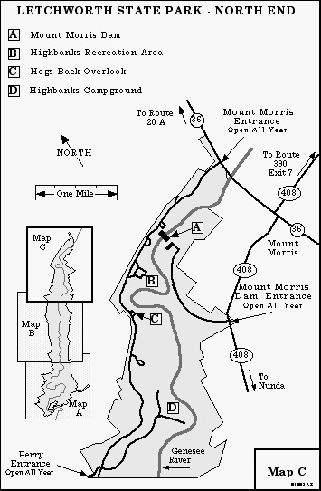
Letchworth State Park is located in the western half of New York State, 35 miles southwest of Rochester, between Mount Morris and Portageville. There are six entrances to the park, four located on the western side and two on the eastern side. The four western entrances are: Mount Morris (from Route 36), Perry (from Route 39), Castile (from Route 19A), and Portageville (from Route 19A). Nearly all of the waterfall viewing areas are reached best by using the western entrances. The two eastern entrances are the Parade Grounds (from Route 436), and Mount Morris Dam (from Route 408). The Parade Grounds and Portageville entrances are closed during the winter months. As is the park road from the Perry Entrance to the Castile Entrance. This page is part of the Letchworth State Park Information page by the Western New York Waterfall Survey.
Web Site: Letchworth State Park
Below the Letchworth State Park area map are 3 maps that show the park in more detail. Click on a link to the right of the area map to go to information on that waterfall. Next to the last map is a list of the major falls in the park and their height in feet.

| NAME OF FALLS |
HEIGHT |
| |
|
| The Upper Falls |
70 |
| The Middle Falls |
107 |
| The Lower Falls |
70 |
| Timber Tunnel Cascade |
140 |
| Shadow Cascade |
14 |
| Deh-ge-wa-nus Falls |
14 |
| Wee Water Willy |
117 |
| Deh-ga-ya-soh Falls |
150 |
| Inspiration Falls |
350 |
| Paul Rock Cascade |
35 |
| Denton Brook Cascade |
500 |
| Cinderella Cascade |
500 |
| Youngest Stepsister Cascade |
500 |
| Eldest Stepsister Cascade |
500 |
| Stepmother Cascade |
470 |
| Wolf Creek Cascade |
225 |
| Canoe Shower Falls |
40 |
| Crucifix Cascade |
70 |
| Wriggling Waters |
60 |
| Abutment Falls |
50 |
| Detour Cliff Cascade |
110 |
| Horse Tail Falls |
130 |
| Sawmill Chute |
13 |
|
| Waterline Cascade |
10 |
|
| Waterline Falls |
19 |
|
| Paper Mill Falls |
49 |
|
| Crapsey Clay Falls |
200 |
Copyright © 2016 by Scott A. Ensminger.
This information may not be reproduced without written permission.
 You can send me e-mail at: falzguy@verizon.net
Return to Letchworth State Park Waterfall Locations With GPS Data
Return to Waterfalls You Can Visit In Livingston County
Return to Waterfalls You Can Visit In Wyoming County
Return to Waterfall Listing By County
Return to Home Page of WNYWS
