|
To purchase a copy of the guidebook click on the gold button 
Return to Waterfalls You Can Visit In Letchworth State Park
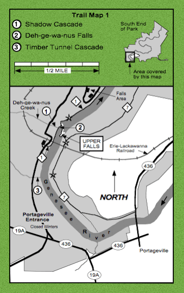
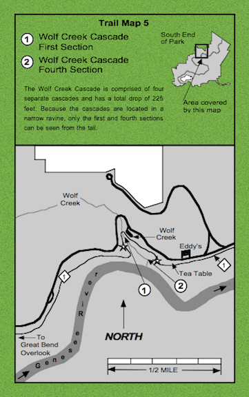
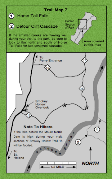
Below are nine trail maps of Letchworth State Park. These maps show a small region of the park in more detail, showing park roads, parking areas, the locations of the waterfalls, and the trails used to reach the best viewing areas. Trails are indicated by thin black lines, with the trail number inside a diamond. In the park, trails are marked by yellow paint blazes. On the trail maps, waterfall viewing areas are indicated by a star on or near the trail. Spur trails, branching off of the main trail, are indicated by a broken line. The arrows in the Genesee River show the direction in which it is flowing.
This information may not be reproduced without written permission.
Return to Waterfalls You Can Visit In Livingston County Return to Waterfalls You Can Visit In Wyoming County Return to Waterfall Listing By County Return to Home Page of WNYWS |


 You can send me e-mail at: