Lyndonville Dam
Lyndonville, New York

Lyndonville Map

Location: Northwestern Orleans County on Johnson Creek in the Village of Lyndonville.
    Starting from the intersection of Routes 104 and 63, follow Route 63 (Lyndonville Road) north for 4 miles to the Village of Lyndonville. Find a place to park on the side of the road near the Yates Community Library. From the library walk north to Johnson Creek. The dam will be to your left (west).

    I know, I know, it is not a waterfall. I have had a few requests to do a web page on it. It is worth taking a look at if your in the area.

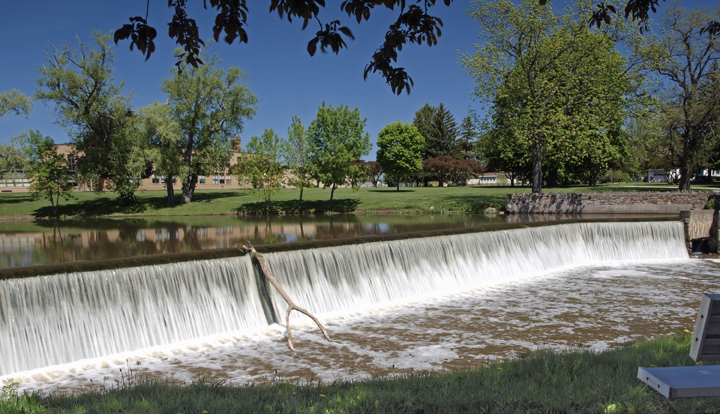
Lyndonville Dam 01

    The Lyndonville Dam is 180 feet wide and 9 feet high. The dam faces to the east and has a crest elevation of 316 feet above sea level. The dam was originally built by early settlers of the area to harness the water power of the creek. Johnson's Creek is named for Sir William Johnson, a British Indian agent.

Lyndonville Dam 02

    The Village of Lyndonville was incorporated in 1903. It is one square mile in size and and is located in the Town of Yates.


For a Map Quest map of the area click here.

For a ACME Mapper 2.0 map of the area click here.

Web site: Yates Community Library


Copyright © 2010 by Scott A. Ensminger.
This information may not be reproduced without written permission.

    You can send me e-mail at: falzguy@verizon.net
Return to Waterfalls You Can Visit In Orleans County

Return to Waterfall Listing By County

Return to Home Page of WNYWS